NORTH METRO FASTTRACKS CORRIDOR PLANNING
Client:
Regional Transportation District
Location:
North Metro Corridor
Program:
Transit Planning and Conceptual Design
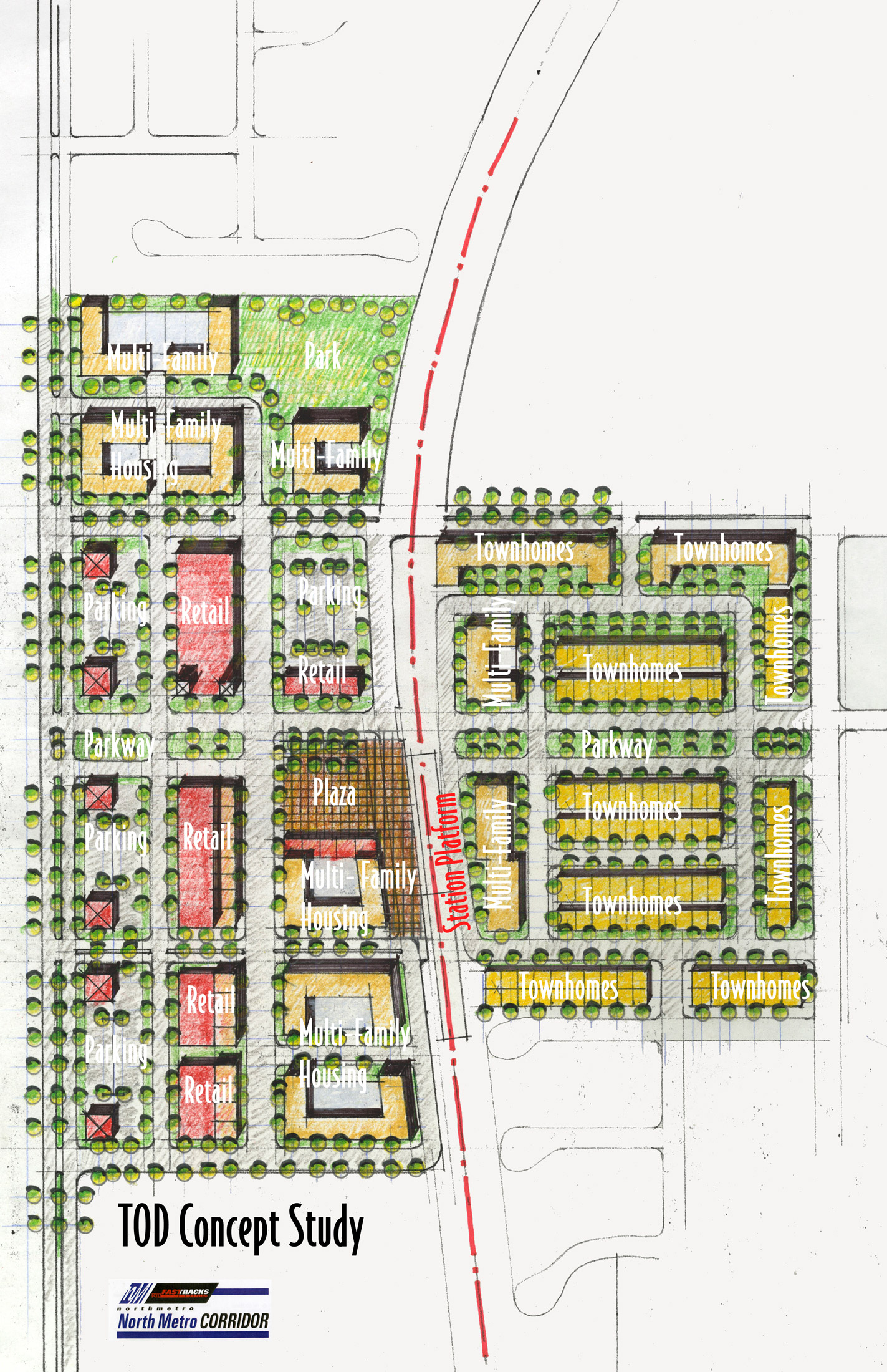
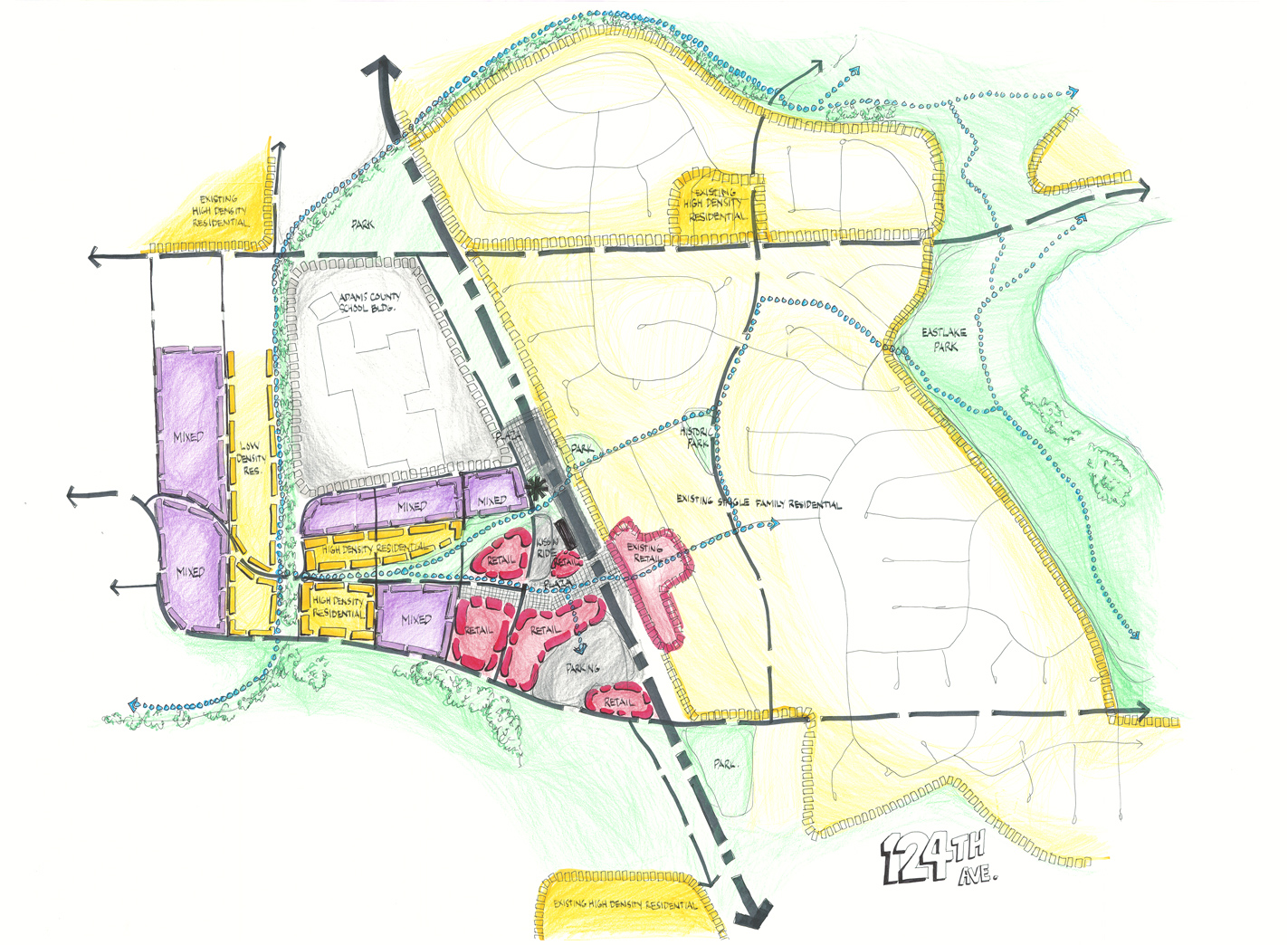
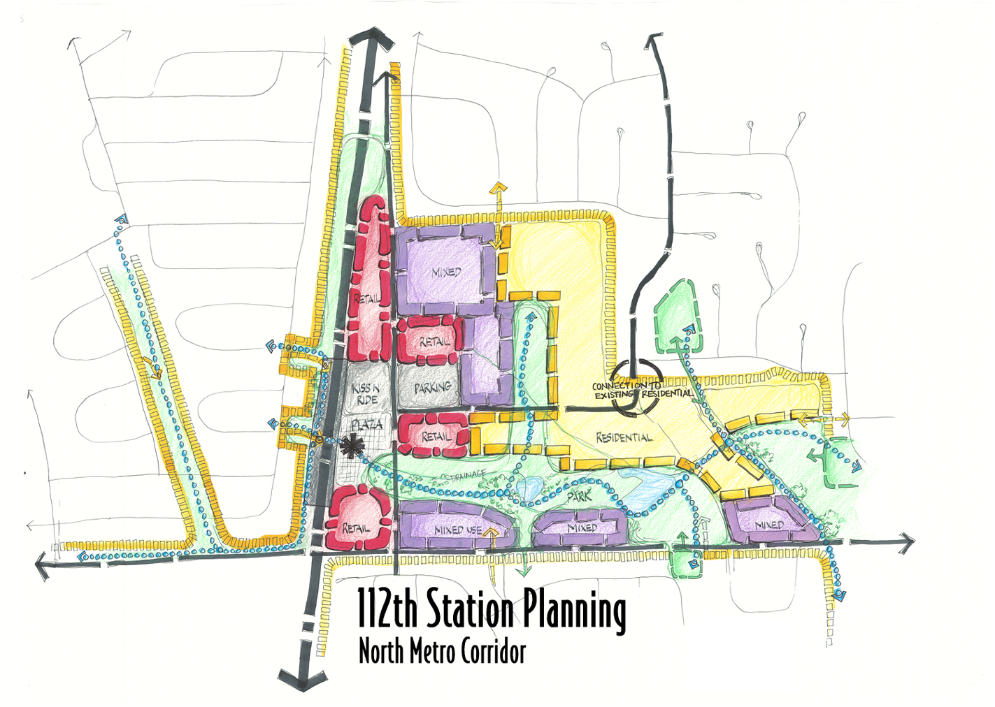
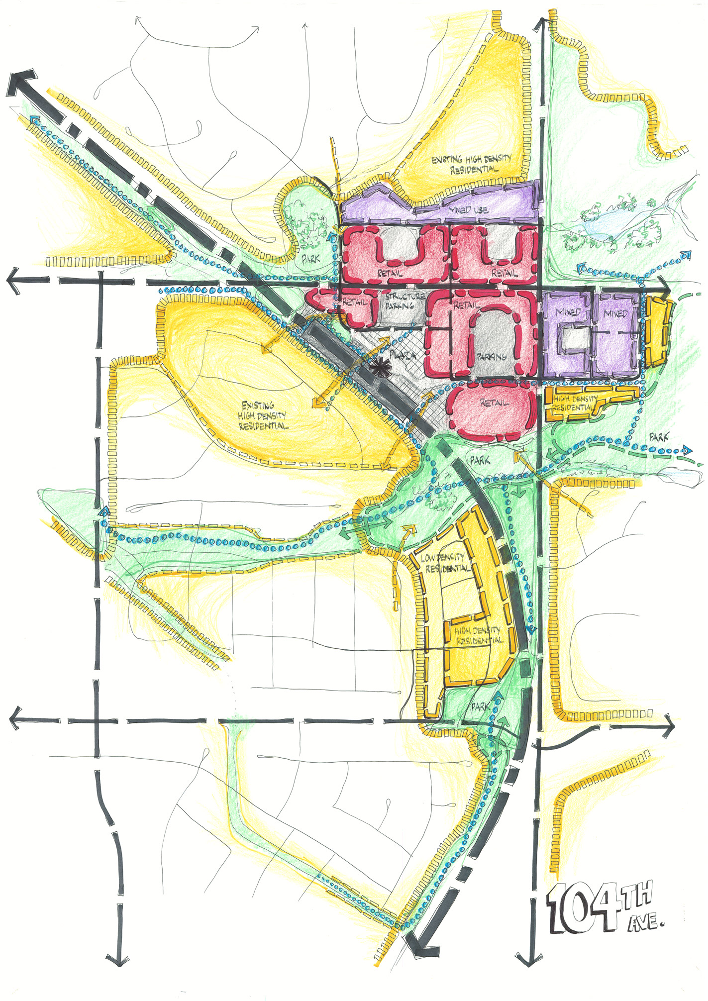
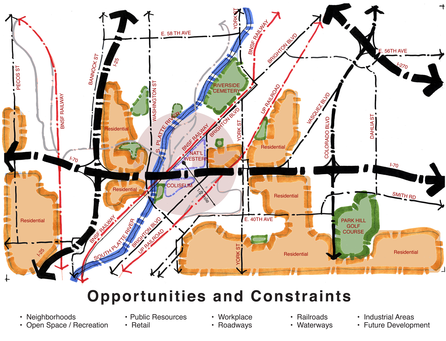
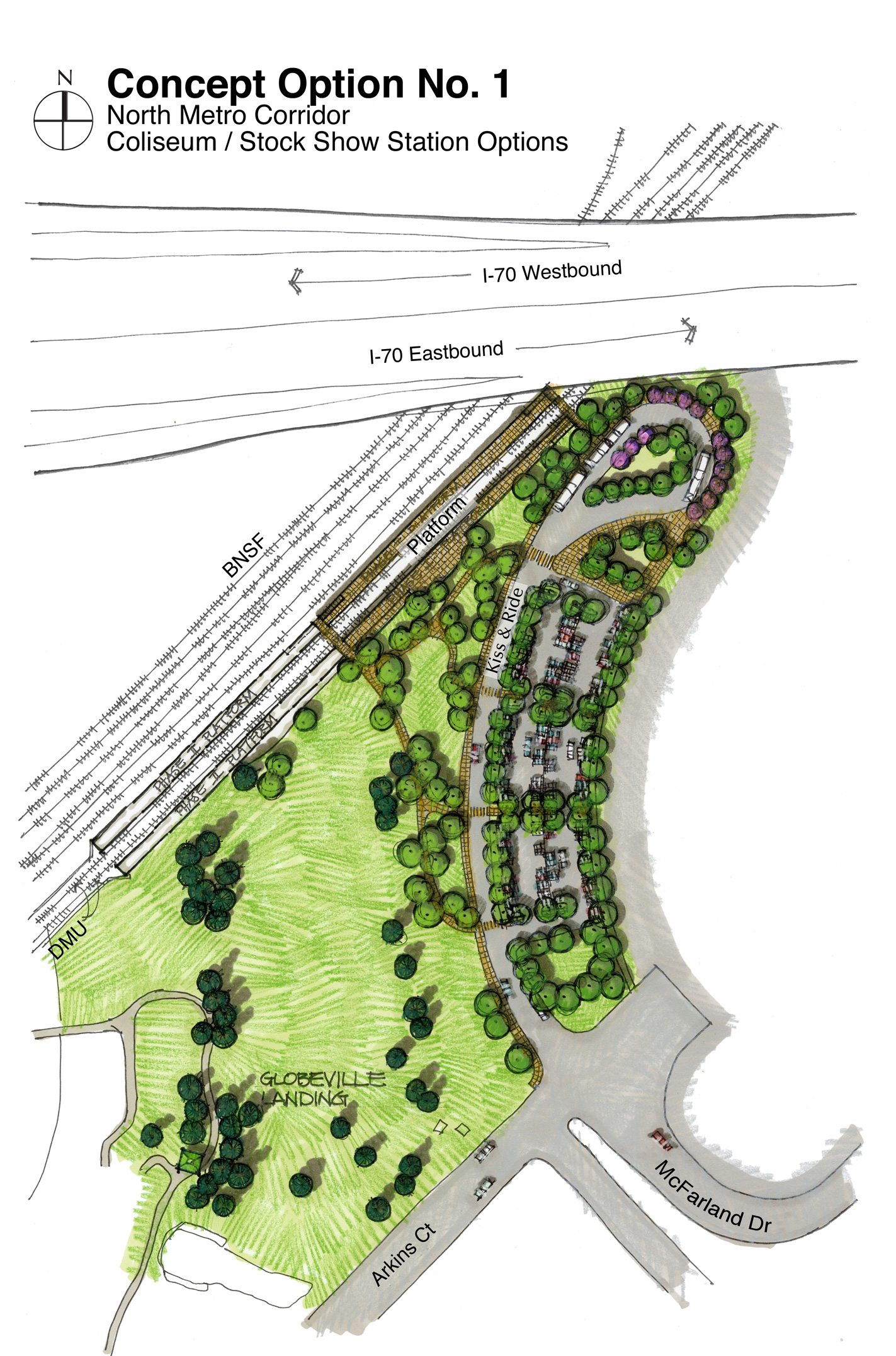
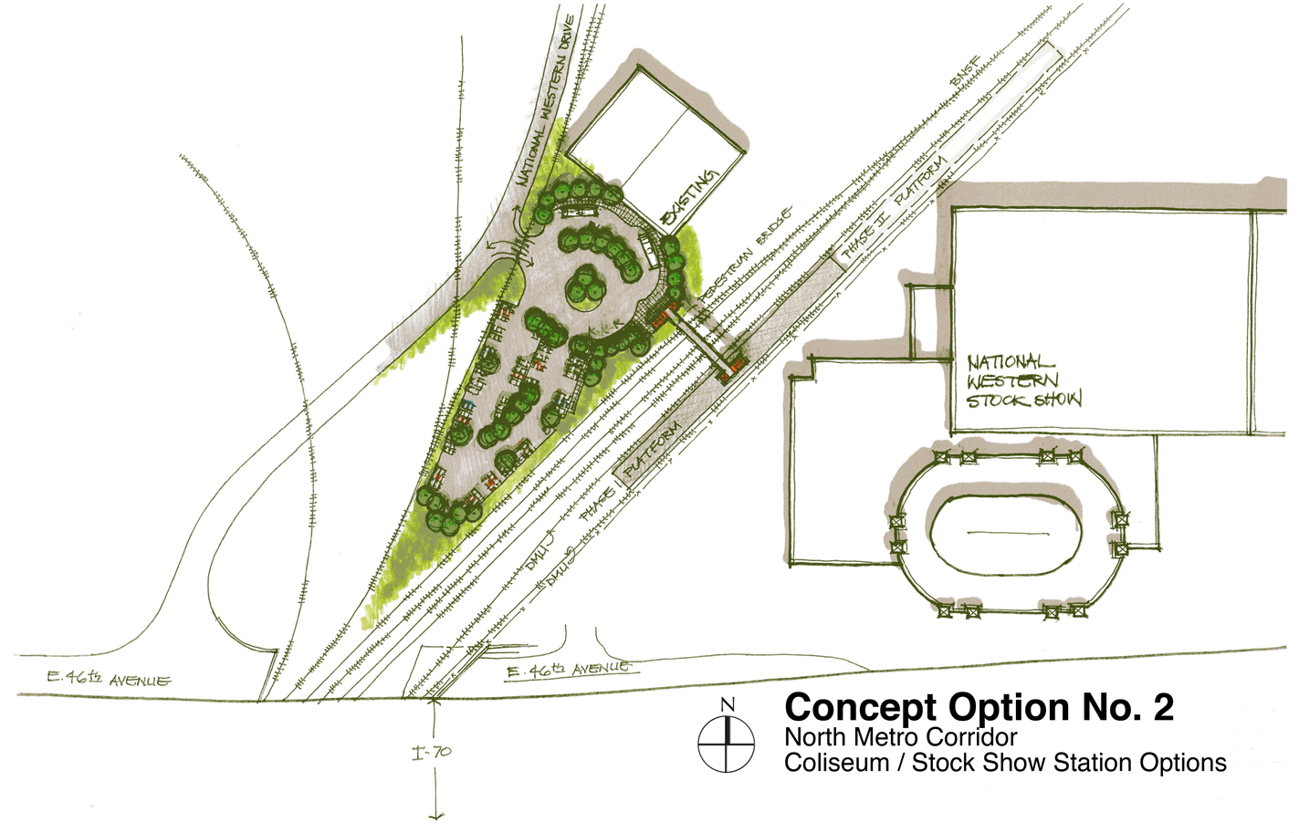
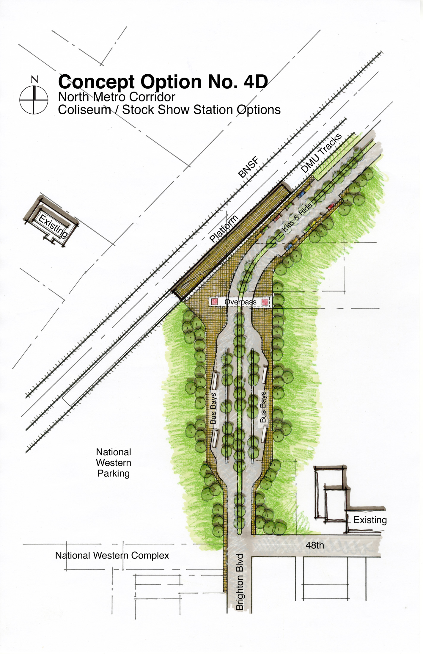
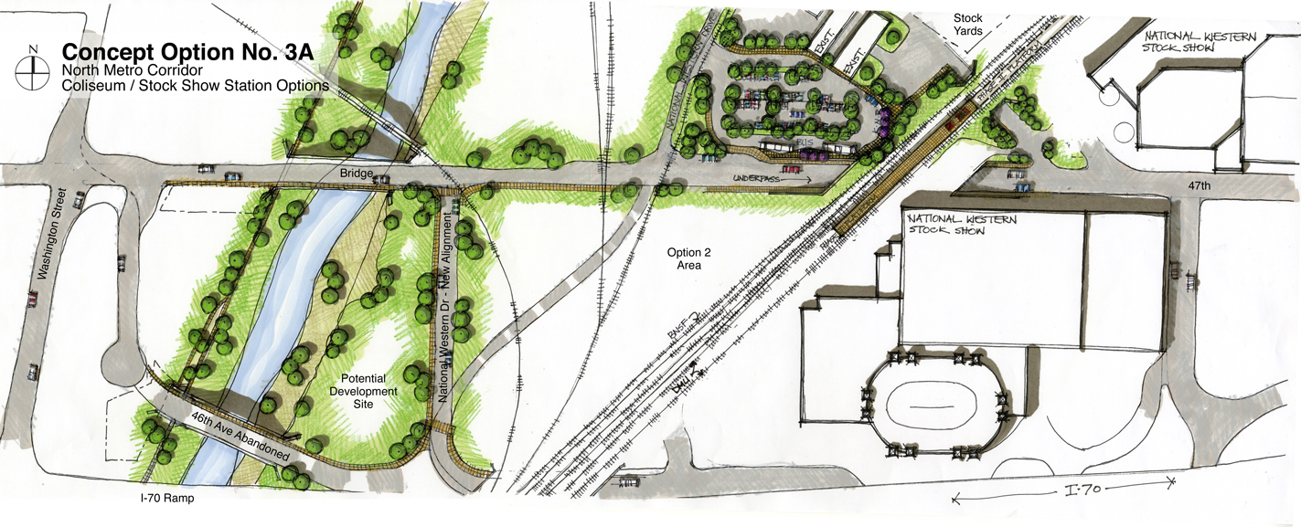
The Roybal Corporation is a part of the transportation consulting team selected to participate in the transportation and urban planning associated with the completion of the North Metro Environmental Impact Statement. The role of the Roybal Corporation is to assist in the development of Station Area Plans, Transit Oriented Development Opportunities, and to participate in community outreach presentations.
The purpose of the North Metro Corridor Environmental Impact Statement is to analyze transit alternatives in the corridor that runs between Denver’s Union Station and 162nd Avenue, passing through Denver, Commerce City, Thornton, Northglen, and unincorporated Adams County.
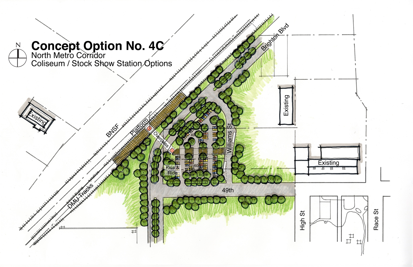
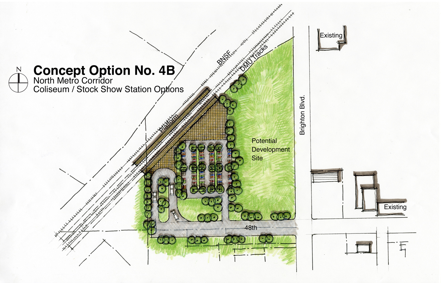
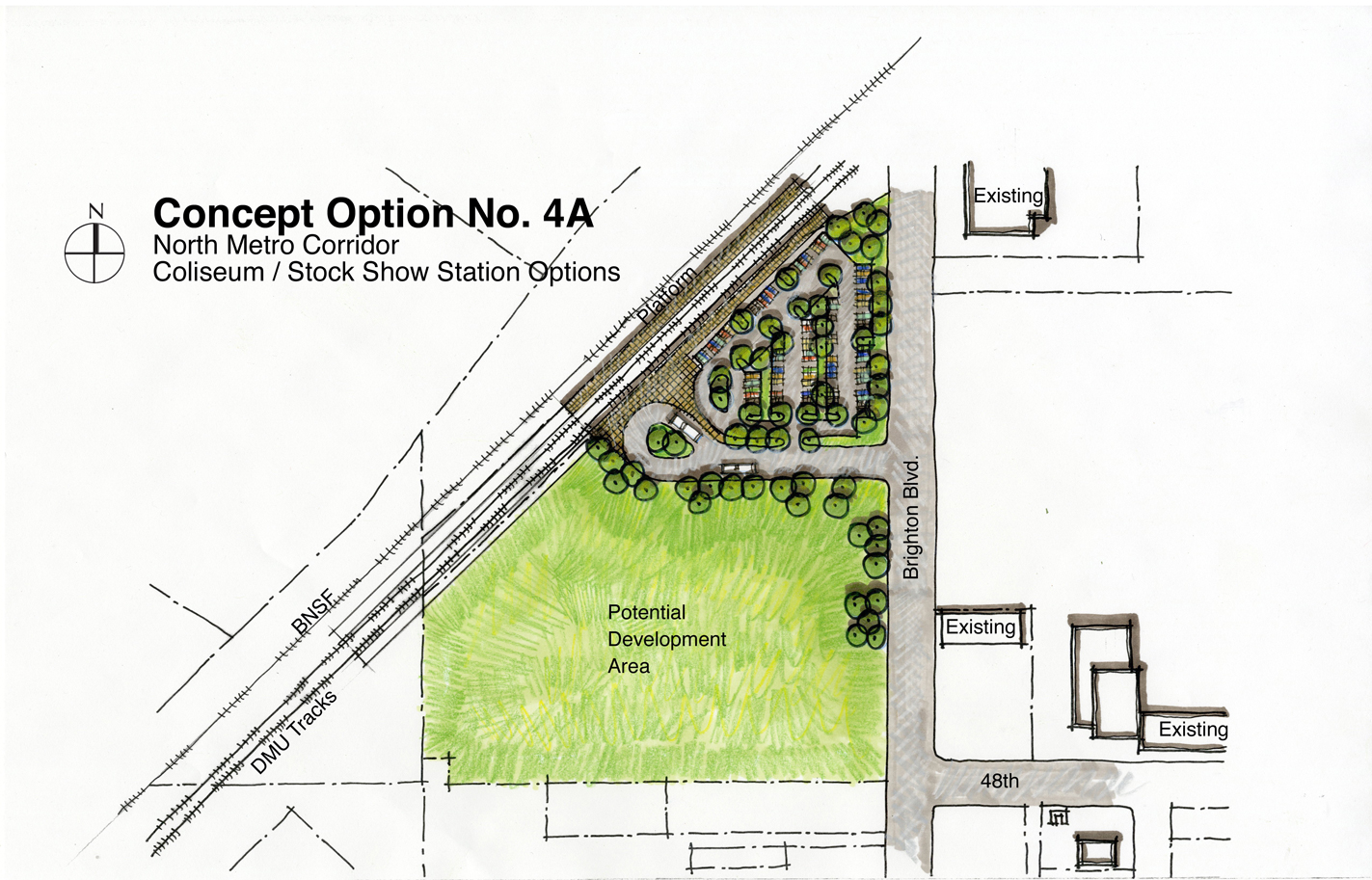
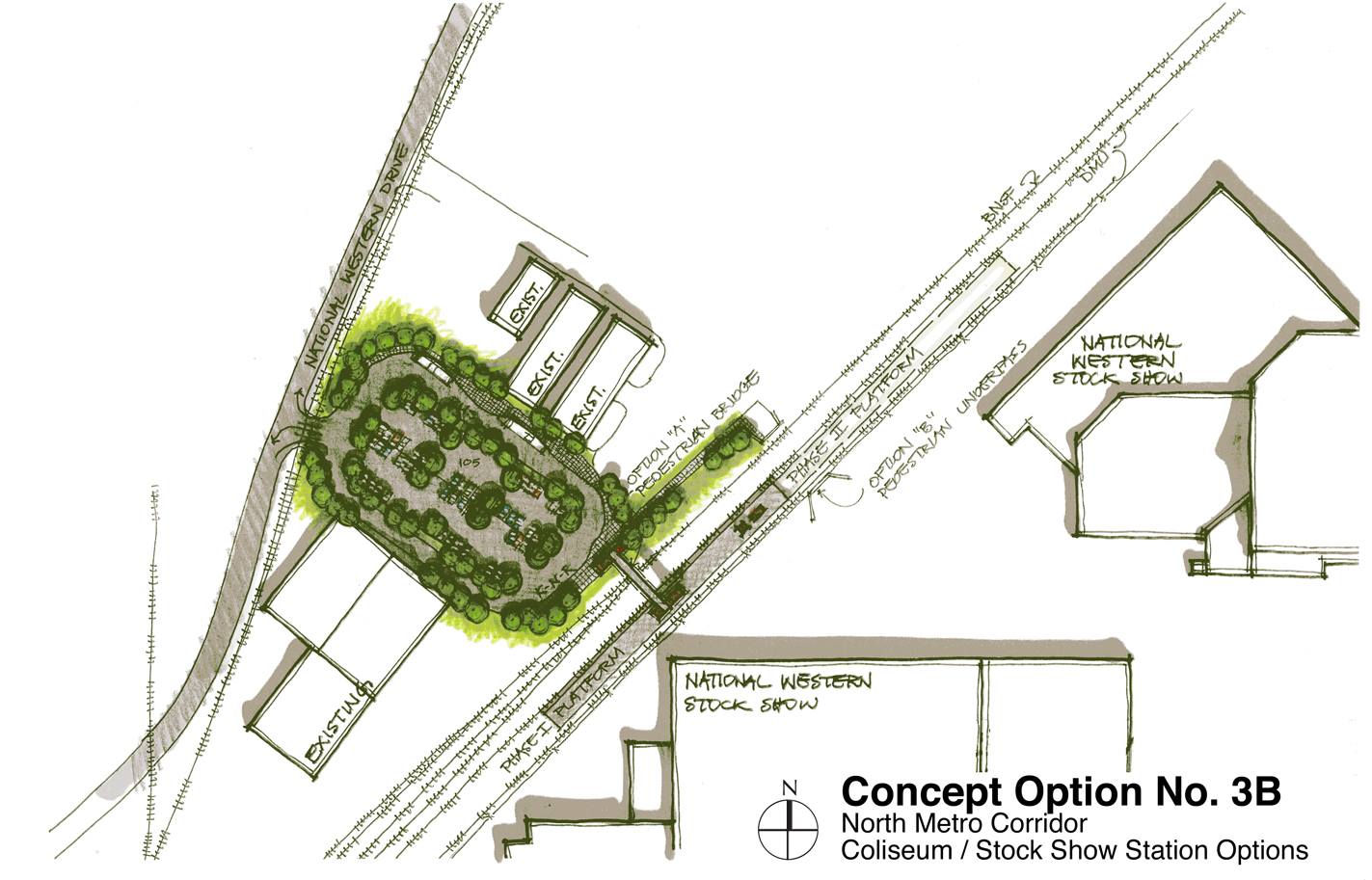
Working with the firm of URS as a planning and design consultant, we are studying 8 stations located along the North Metro Line that begins at Union Station and provides up to 162nd Ave. Each station location has a series of alternative station plans that were presented to the communities at public meetings. each alternative then went through a detailed ranking process in order to recommend the best solution for reach location.